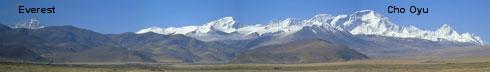
 View from Tingri | |||||||||||||||||||||||||||||||||||||||||||||||||||
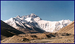 View from Nnorth Base Camp | 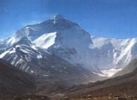 from Lamna-La Pass | ||||||||||||||||||||||||||||||||||||||||||||||||||
| Mt. Everest looms up at the end of the valley 11 miles (as the crow flyes) from base camp. Local Tibetans know the mountain as Chomolungma, "Mother Goddess of the Earth". Views of its North Face are even more stunning than from the Nepal side. | |||||||||||||||||||||||||||||||||||||||||||||||||||
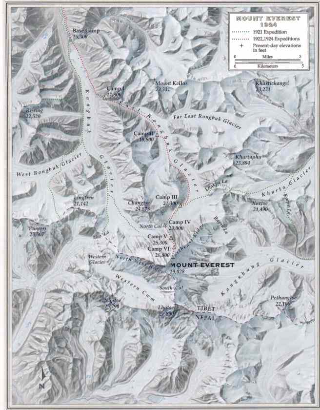
The route is initially a straightforward trail up moraine to the East
Rongbuk Glacier to Advanced Base Camp, which leads to the fixed ropes. The descent from ABC takes around three hours. The traditional camp numbers are listed. Some recent expiditions make Camp 1 at the North Col. Maps: Mt. Everest Region Map | Relief map | Mallory's presumed route from Camp VI (Step 2 and 3) See: Everest at NOVA (PBS): QTVR (360°) view from summit. See the Mt. Everest page for more.
Return to Tibet
| |||||||||||||||||||||||||||||||||||||||||||||||||||
