 Places
Everest
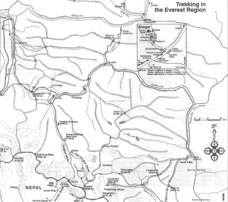
N. Everest Region Map (Go to Print Version)
Places
Everest
N. Everest Region Map (Go to Print Version)
| Don's Home
Places
Everest
N. Everest Region Map (Go to Print Version)
| Contact |
In the Lonely Planet "Tibet travel survival kit" they say: "There is a short cut over the pass that is used by locals. If your guide wants to use it, bear in mind that it is steeper and crosses the pass at a higher point".
After the rainy season you can also take 4 wheel drive vehicles over several routes from Old Tingri.
On Eric Bolz' Travel Page he says:
Day 2: On my way to Everest Base Camp. I'm climbing up to the Lanma La, approximately 17,000 ft (6000 m) Actuall, I got a little lost. My book's description of the pass was a little misleading and I ended up walking much higher than I needed to. If you do it correctly you will find that if you look to your right as you cross the pass (at about 17,000 feet) you will see another pass 1000 feet higher. So it is really a sort of double pass. Well, I walked all the way up to the other pass because my book said I should stay to the right. I guess I stayed too much to the right and I came to the wrong pass. I thought something might be wrong so I used my compass for the first time ever. Ten it became clear what I had done wrong. So I walked back down to the correct pass and pitched my tent at 17,000 ft. It was an interesting feeling, being totally alone in the middle of the mountains. But I had plenty of water and food so I was quite comfortable. I had the whole place to myself that night.
Whichever pass you take the views from hear are great. According to Rainer Stalvik's web site you can drive over Lamar La.
"Lamar La, 5 662 mas, on the road from Tingri to Rongbuk was the highest pass we drove over. The view from the pass is called "Top of the World". From here you can see four of the highest mountains in the world, if you are lucky, Mount Everest, Lhotse, Makalu and Cho Oyo."