NE New Jersey
Raritan River
NE New Jersey
Raritan River|
Places
NE New Jersey
Raritan River |
|
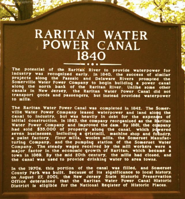
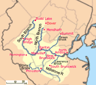
This is a copy of the Raritan River page that used to resided on the NJ Sierra Club Raritan Valley Group page. See the Raritan River Basin page there for the new version. The Raritan watershed commonly known as the Raritan River Basin covers 1,100 square miles, including the lower Raritan River the North and South Branches of the Raritan and the Millstone River and tributaries. It is the largest river system entirely within New Jersey. The Raritan River proper forms at the confluence of the North Branch and the South Branch just west of Somerville. It flows 16 miles before slowing in tidewater at New Brunswick. Its estuary extends 14 miles more until the Raritan Bay at South Amboy. It supplies (via pumping) the Spruce Run (1963) and Round Valley (1965) reservoirs. The name was probably derived from an Algonquian word meaning "stream overflows," or "forked river. | |
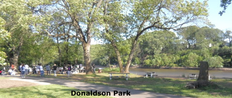
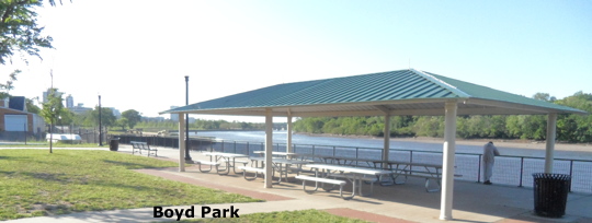
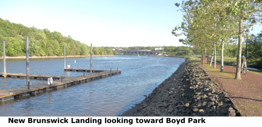
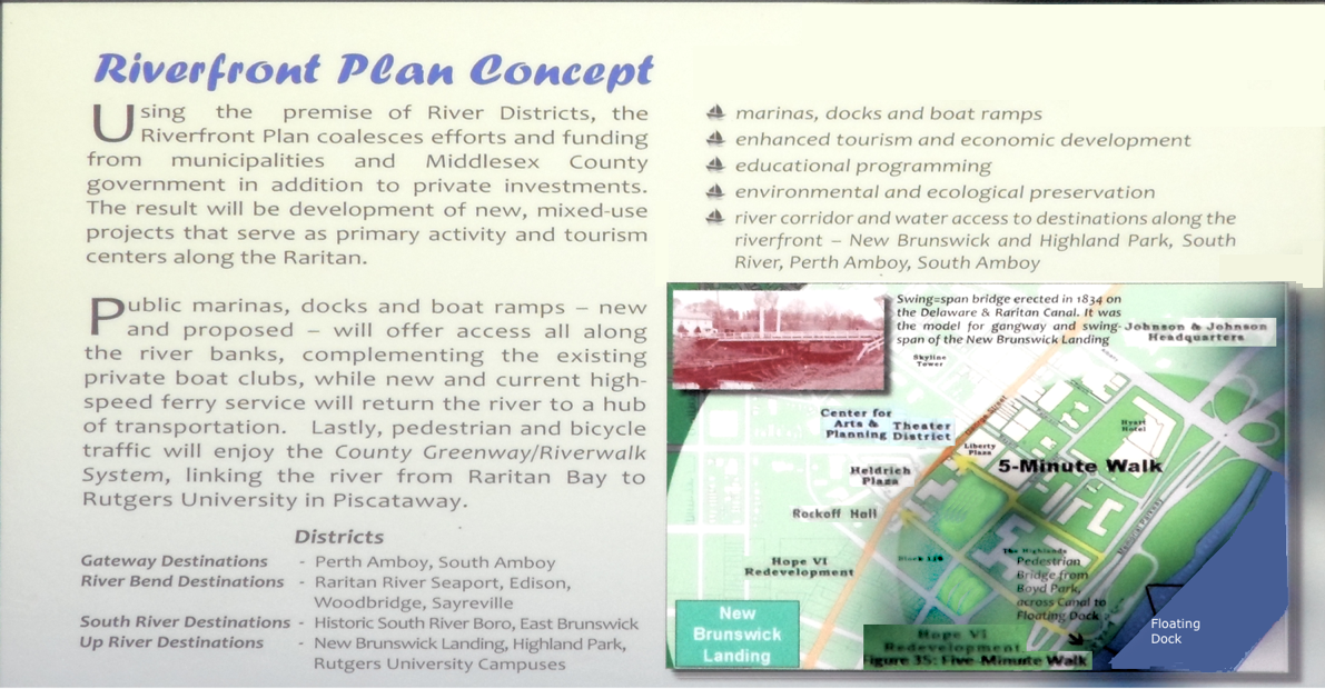
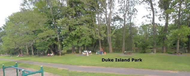
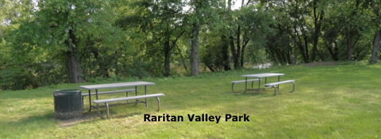
Lower Raritan Parks, Recreation and Picnic Areas: New Brunswick Area Somerville Raritan Area Piscataway North Branch South Branch See also: Public Access and Recreation at The Rutgers Sustainable Raritan River Initiative Lower Raritan - Walking, Biking & Parks |
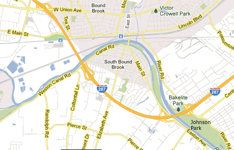
 Other Maps:
NOAA Raritan River Basin Maps at NoWater-NoLife (NWNL) |
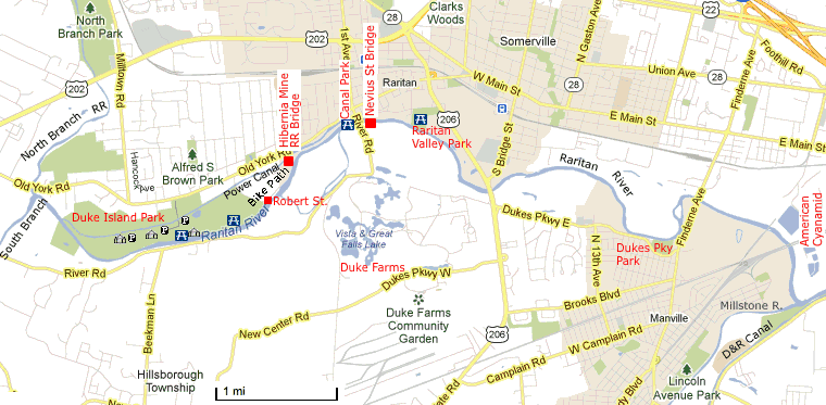
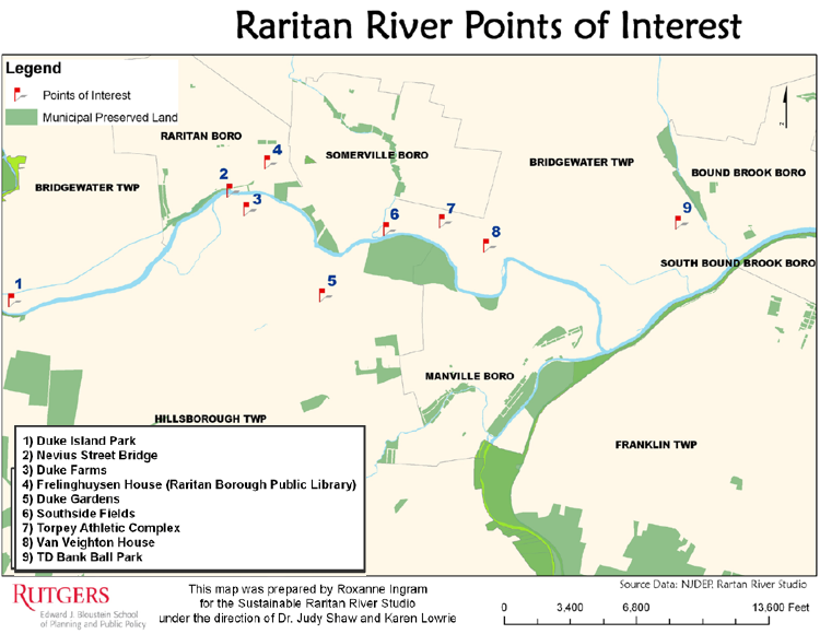
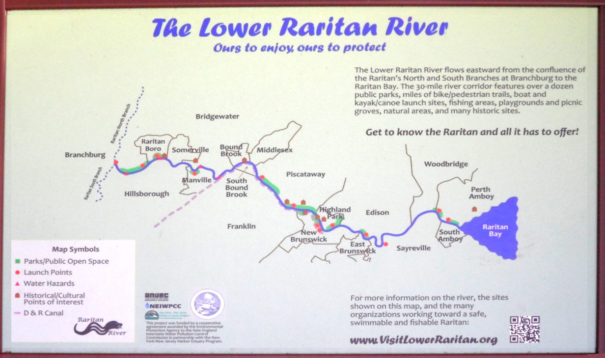 Click on map for a larger version. | VisitLowerRaritan.org See also Lower Raritan - Walking, Biking & Parks at the Association of New Jersey Environmental Commissions - ANJEC.org and their Interactive Google Earth Map Parks near New Brunswick 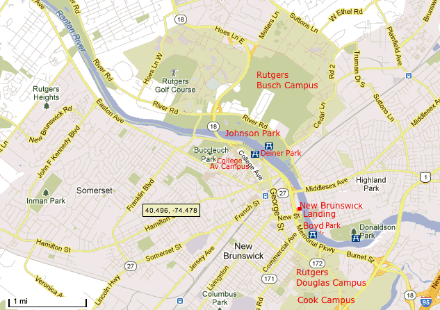
Parks near Somerville-Raritan
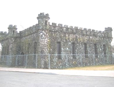
In 1897 James Buchanan Duke acquired control of the Raritan Water Power Company.
In 1898 he completed his first Power house with 3 turbines one devoted to electrical power for Duke Farms.
See:
Piscataway North Branch: Starts in Mine Hill that's also known as Black River and the Lamington Riveras. See: North Branch Raritan River Site 2 | Raritan Headwaters Association North Branch Raritan River - Wikipedia North Branch Park
South Branch Fishing: The Raritan is heavily stocked with spring trout. In addition to American shad, hickory shad, herring and striped bass also come upriver from the ocean. See: NJDEP Division of Fish & Wildlife - Fishing Access Locations on Trout Waters by County Dredging: In 2003 several dredging projects were proposed for flood mitigation, to help Revitalize New Jersey Waterfront and provide access to Brownfield sites. They included projects in New Brunswick, Sayerville and South Amboy. It would also foster recreational boating from the Raritan Bay up to the Albany Street Bridge in New Brunswick. Dredging was done in the area of New Brunswick Landing in the Spring of 2013. See: Waterfront Redevelopment www.raritan.rutgers.edu/resources/HDR_Dredging_Study[1].pdf Environmental Issues: Water Quality: "Over 200 contaminated sites are adjacent or drain into the lower Raritan River, including abandoned industrial sites, Superfund sites, old landfills, dredge dumping areas and old army arsenals. Residents continue to be exposed to toxic waste through recreational use of the river and eating contaminated fish despite warning that it may be hazardous to their health." According to the Edison Wetlands Assn The lower watershed, cited as 14th among US rivers polluted by direct and sewer discharges of toxic chemicals (from 1990-1994), has been heavily impacted by intense industrial and storm runoff pollution and heavy flooding due to extensive urban impervious surfaces and climate change.
Raritan River Basin Watershed Management Project (RBWMP) Technical Reports -Surface Water Quality and Pollutant Loadings
Video: Rescuing the River: The Raritan | NJTV Public Media NJ Video, 2012, 57 min.
Dams restricting fish spawning: "Dam removal benefits public safety and welfare, water quality, biodiversity, ecological integrity, and the local economy. For these reasons, a consortium of conservation organizations, watershed groups, and other restoration practitioners approached the New Jersey Department of Environmental Protection (NJDEP) to encourage them to address regulatory constraints and modify procedures with the intention of fostering the practice of dam removal in the State of New Jersey.The removal of three dams in Somerset County is intended to open a 10-mile stretch of the middle and upper portions of the river to a spring spawning run of American shad all the way to the Headgates, a waterfall dam at the upstream west end of Duke Island Park. In addition to American shad, hickory shad, herring and striped bass also come upriver from the ocean.
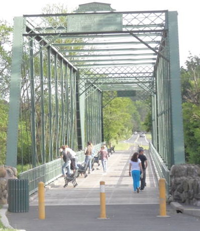
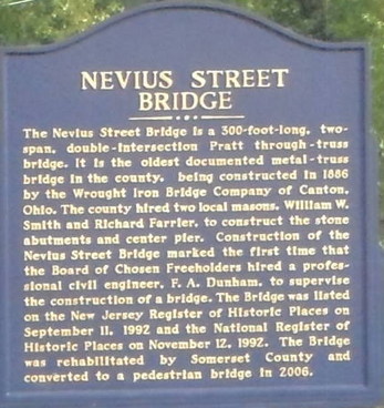
The second dam was removed in the Fall of 2012. In July 2013 Duke Farms settled a dispute with the DEP and removal of the Nevis St. was scheduled to start.
The removals were financed by the Houston-based El Paso Corporation, which is now Kinder Morgan,
as compensation to the public for harm to natural resources from pollution at a refinery and three polymer plants operated by them.
Be River-Friendly - What you can do Organizations: [Top] The Rutgers Sustainable Raritan River Initiative - raritan.rutgers.edu Raritan Riverkeeper at NY/NJ Baykeeper Raritan Riverkeeper | Metropolitan Waterfront Alliance - Bill Schultz The The Lower Raritan at the Association of New Jersey Environmental Commissions - ANJEC.org Edison Wetlands Association - Raritan River Initiative Raritan Basin Watershed Alliance NJDEP - Water, Coastal & Watershed Information Raritan Headwaters Association - NJ's Watershed Watchdog South Branch Watershed Association: The South Branch Raritan River Watershed Upper Raritan Watershed Association, URWA The Stony Brook-Millstone Watershed Association Blue Raritan Raritan Riverkeeper | NY/NJ Baykeeper Central Jersey Stream Team Delaware and Raritan Canal Watch New York - New Jersey Harbor Estuary Program at The New England Interstate Water Pollution Control Commission NEIWPCC.org Raritan River Watershed Project for Teens Raritan Organizations and Municipalities at ANJEC.org Films: Video: Rescuing the River: The Raritan | NJTV Public Media NJ Video, 2012, 57 min. Twin Rivers : The Raritan and the Passaic : The Rivers of America Series: Harry Emerson Wildes,1943 Terms: Ground Water - Rainwater runoff that seeps into the ground to become ground water. Ground water moves into water-filled layers of porous geologic formations called aquifers. NJDEP - New Jersey Department of Environmental Protection Nonpoint Source Pollution - Contamination that results from everyday activities such as fertilizing the lawn, walking pets, changing motor oil and littering. With each rainfall, pollutants generated by these activities are washed into storm drains that flow into our waterways and ocean. Riparian Area - Riparian areas are ecosystems adjacent to a river or waterway that, in an undisturbed state, provide habitat for wildlife and help improve water quality. Riparian areas are usually transitional zones between wetland and upland areas and are generally comprised of grasses, shrubs, trees, or a mix of vegetation types that exist within a variety of landscapes (e.g., natural, agricultural, forested, suburban, and urban). Surface Water - Water in lakes and streams Watershed - The area of land that drains into a body of water WMA - Watershed Management Area See NJDEP-Watershed Restoration-Watershed Information Contacts: The Raritan Riverkeeper - Bill Schultz Contact: Lorraine McCartney - (732) 442-6316 raritan.riverkeeper@verizon.net
The Sustainable Raritan River Collaborative at Rutgers U. - Dr. Judy Shaw, Project Director
Edison Wetlands Association (EWA) - Robert Spiegel, ED Links: Sustainable Raritan River - rutgers.edu Lower Raritan Riparian Corridor (www.co.somerset.nj.us) Lower Raritan River Access (www.anjec.org) Lower Raritan - Walking, Biking & Parks (www.anjec.org) Environment and History (www.anjec.org) Visioning the Future Raritan River, 2010 Raritan River Access Points by the Raritan Riverkeeper, 2009 Printed maps available for $2 at Raritan Riverkeeper See http://waterkeeper.org/united-states/raritan-riverkeeper/ raritan.riverkeeper@verizon.net
DEP says Raritan River dam removal in Somerset County will kick start fish spawning | NJ.com, 2011 Colonial Park Brochure (also with beautiful rose and perennial gardens, as well as bike paths, etc)
Delaware and Raritan Canal
| |
 -Gazebo or Pavilion;