1778-1779 Angelakos Map
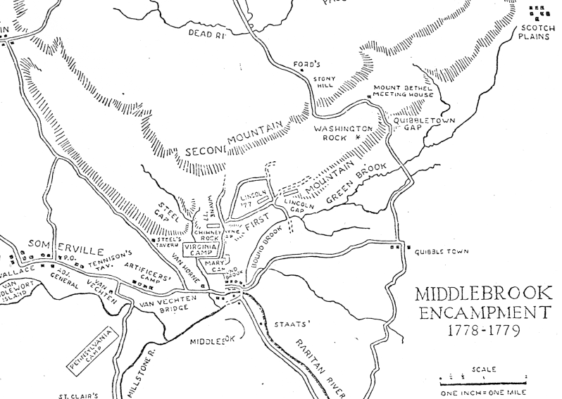
" The Army at Middlebrook 1778-1779", Peter Angelakos, 1952, Proceedings of the New Jersey Historical Society, vol. 70, no. 2 Copy from "Report on a Preliminary Archaeological Investigation of the Alleged Site of the 1777 Summer Encampment of Wayne's Brigade at Middlebrook, NJ", 1974, Liesenbein p. 16
Roads Then and Now:
       Then          Now
Basking Ridge Rd.  Vosseller Ave. [1]
Quibbletown Rd.    Rock Ave.
Lincoln's Gap      King Gorge Rd. [1,2]
Mordecai's Gap,   |
Wayne's Gap,      |Vosseller Ave. [1,2]
Oliver's Gap      |
[1] North of the Rariton Lotts p. 94[2] above map
Note: Liesenbein in "Report on a Preliminary Archaeological Investigation of the Alleged Site of the 1777 Summer Encampment of Wayne's Brigade at Middlebrook, NJ", 1974, p. 17, states that "No Revolutionary War map with passes labelled Wayne's and Lincoln's is known to at this time."